Weather overlay maps in CalTopo and Gaia GPS
How much snow or rain is in the forecast?
Where can I go hiking this weekend where it might be dry?
I‘m a powder skier looking for the heaviest new snowfall, where should I go?
I need to make a long drive; which route might have the least amount of snow?
The superb desktop mapping tools CalTopo and GaiaGPS have a very helpful overlays that that gives a color-coded big picture, and the option to take a closer look at a detailed forecast.
(While CalTopo includes this handy feature for free, I highly recommend subscribing to CalTopo to support the small team of developers that make this superb tool available, hint hint. For Gaia users, this feature is for Premium level subscribers.)
CalTopo
Zoom into your area of interest, here the northern Oregon Cascades near Portland. From the right sidebar menu under Forecasts, check “Weather Shading” and choose “48hr Snowfall” from the drop-down menu. (For today we’re interested in snowfall, but you can also choose low / high temperatures, rain, and wind speed / gust.)
Here I'm using Open Street Map as a base layer (selected from the top right corner menu). It doesn’t have contours, so it draws a bit faster if you're looking at a large area. You can choose any base map you like. To show some topography, check out the “TF Outdoors” map layer.
The legend is along the bottom. Light blue > purple > gray = increasing amounts of snow.
If you zoom in, you'll see some numbers. This is the estimated snowfall in inches for the next 48 hours. (Data are based on the National Weather Service (NWS) forecast grids, which are about 2.5 km square.)
Yep, that's up to 30 inches of new snow on Mount Hood in the next 48 hours!
Need more details? Right click anywhere on the map, and choose “NOAA Forecast” to get a point forecast for that location.
This opens up a new browser tab, and gives you a detailed forecast from the National Weather Service for that location.
Finally, if you're planning a long winter drive and wondering which route to take to avoid snow, zoom out for a regional view.
GaiaGPS
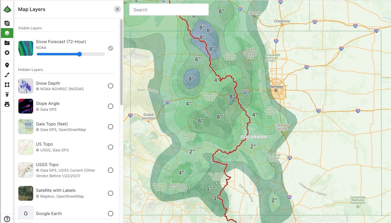
Gaia offers a similar feature. You can change the opacity of the overlay with the slider bar (here about 70%).
You can choose between 24 hour, 48 hour, and 72 hour overlays. Find them under the “Feature/Weather Overlays” menu. This overlay is available for Premium subscribers.
Photo is a screen grab of a spring storm in Colorado, in late April, 2022.


