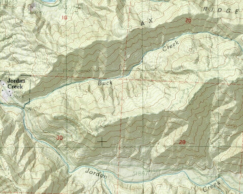
Shaded relief - helpful, and a fun optical illusion
An ordinary topographic map can look like a big bunch of squiggles, and it takes practice to “read” the contour lines to make out landforms like ridges and gullies. A clever bit of cartographic wizardry known as “shaded relief” (aka hill shading, or terrain shading) tricks the brain into seeing terrain features such as ridges and gullies more in 3-D, extremely cool!
Here’s a side-by-side example of the exact same terrain. The top map is the standard topographic map, and the contour lines mostly look like a spaghetti pile. On the bottom is the same area with shaded relief added. You can clearly see the streams and ridgelines, nice!
So, here's the fun optical illusion part. If you turn the shaded relief map upside down . . . The streams appear to be ridges, and the ridges appear to be the drainages! Check out the map below. Jordan Creek and Buck Creek appear on a ridge . . . but you know creeks don't go on ridges! If you're seeing this on your phone, you can take a screenshot and turn it upside down also.
Pretty cool, no?
This does have some occasional practical use in the field. If you have a shaded relief map, and you rotate the map so south is at the bottom (called orienting the map, which you might do when walking south) be aware of this illusion, because what you see on the map might well trick your eye.
Some navigation experts claim that you should not use shaded relief at all because of this potential for error. I disagree. The huge increase in legibility for the average user is a massive benefit that far outweighs the potential eye trickery when you may occasionally view the map upside down.
You can create shaded relief maps like this for free from the great mapping website Caltopo.com. Lots of Caltopo is free, but for a modest $20 annual subscription you can access even more. If you love maps, please consider a subscription to support the creators of this very helpful mapping tool, hint hint.
Learn to use Caltopo from this YouTube video.


